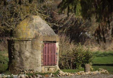
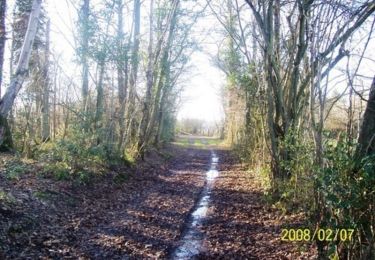
Tour Wandern Tourouvre au Perche - Bubertré - Lignerolles (Boucle) - Photo

Bubertré - Lignerolles (Boucle)

 neitag61
neitag61

Benutzer

© OpenStreetMap contributors
Länge
Länge
12,3 km
Maximale Höhe
Maximale Höhe
323 m
Positive Höhendifferenz
218 m
Km-Effort
Km-Effort  
15,2 km
Min. Höhe
Min. Höhe
261 m
Negative Höhendifferenz
216 m
Boucle
Boucle
Ja
Erstellungsdatum :
2016-04-15 00:00:00.0
Letzte Änderung :
2016-04-15 00:00:00.0

(1 Nachricht)

Wandern
Wandern
3h00
Schwierigkeit : Einfach

Scannen Sie diesen QR-Code, um die Tour in der SityTrail-Anwendung zu öffnen

Kostenlosegpshiking-Anwendung

Logo SityTrail SityTrail

IGN / Geografische Institute

SityTrail aus dem App Store herunterladen SityTrail von Google Play herunterladen

Logo SityTrail SityTrail World

Die Welt öffnet sich für Sie

SityTrail aus dem App Store herunterladen SityTrail von Google Play herunterladen SityTrail auf Huawei AppGallery herunterladen

Über SityTrail

Tour Wandern von 12,3 km verfügbar auf Normandie, Orne, Tourouvre au Perche. Diese Tour wird von neitag61 vorgeschlagen.

Höhenprofil

Ort

Land:
France
Region :
Normandie
Abteilung/Provinz :
Orne
Kommune :
Tourouvre au Perche
Standort:
Tourouvre
Gehen Sie:(Dec)
Gehen Sie:(UTM)
325979 ; 5384673 (31U) N.

Kommentare

Bitte melden Sie sich an, um einen Kommentar oder eine Bewertung zu hinterlassen


Merci Neitag61. Randonnée facile et très agréable, ombragée sur sa plus grande partie. En période humide, il faut sans doute prévoir des bottes pour certains tronçons.


Touren in der Umgebung

Tour Wandern Longny les Villages - La Fonte - Malétable 7,8 km - Photo
Wandern
ODDAD78

Wandern

Einfach
Longny les Villages, Normandie, Orne, France
7,8 km | 9,2 km-effort
21min
Ja
Tour Wandern Tourouvre au Perche - [Itinéraire] Parcours de découverte de la Réserve de Bresolettes - Photo
Wandern
ODDAD78

Wandern

Einfach
Tourouvre au Perche, Normandie, Orne, France
4,2 km | 4,8 km-effort
1h 5min
Ja
Tour Wandern Tourouvre au Perche - Bellegarde - Autheuil  - Photo
Wandern
tracegps

Wandern

Einfach
(1)
Tourouvre au Perche, Normandie, Orne, France
3,8 km | 4,8 km-effort
1h 19min
Ja
Tour Mountainbike Tourouvre au Perche - [Itinéraire] Les ruines du château de Gannes - Photo
Mountainbike
ODDAD78

Mountainbike

Schwierig
Tourouvre au Perche, Normandie, Orne, France
28 km | 34 km-effort
2h 20min
Ja
Tour Auto Tourouvre au Perche - 2024-02-24 Perche Trappe V du  - Photo
Auto
patrick2m

Auto

Tourouvre au Perche, Normandie, Orne, France
38 km | 45 km-effort
4h 15min
Nein
Tour Mountainbike Tourouvre au Perche - 2023-12-2 vduP perche-trappe  - Photo
Mountainbike
patrick2m

Mountainbike

Medium
Tourouvre au Perche, Normandie, Orne, France
22 km | 24 km-effort
3h 46min
Nein
Tour Wandern Tourouvre au Perche - 2023-10-26 Trappe  - Photo
Wandern
patrick2m

Wandern

Medium
Tourouvre au Perche, Normandie, Orne, France
6,9 km | 7,6 km-effort
2h 2min
Nein
Tour Wandern Tourouvre au Perche - [Itinéraire] L'étang du Cachot - Photo
Wandern
ODDAD78

Wandern

Medium
Tourouvre au Perche, Normandie, Orne, France
6 km | 7,3 km-effort
1h 39min
Ja
Tour Wandern Tourouvre au Perche - [Itinéraire] Parcours de découverte de la Réserve de Bresolettes - Photo
Wandern
ODDAD78

Wandern

Einfach
Tourouvre au Perche, Normandie, Orne, France
4,2 km | 4,9 km-effort
1h 6min
Ja


Schließen
Meine Abonnements